Rare tropical rains threaten California days after historic heat

A heat wave roasting California with some of the hottest temperatures ever recorded there will break on Friday as a rare tropical storm approaches the state.
A sprawling hurricane in the eastern Pacific could plunge southern California straight from a historic heat wave into a threat for flash flooding and damaging winds.
Hurricane Kay made landfall along the western coast of Mexico’s Baja Peninsula on Thursday afternoon. The system brought damaging winds, flooding rains, and rough seas to the region, though the worst conditions only grazed the popular resort city of Cabo San Lucas.
DON’T MISS: California avoids power outages, conservation still needed in heat wave
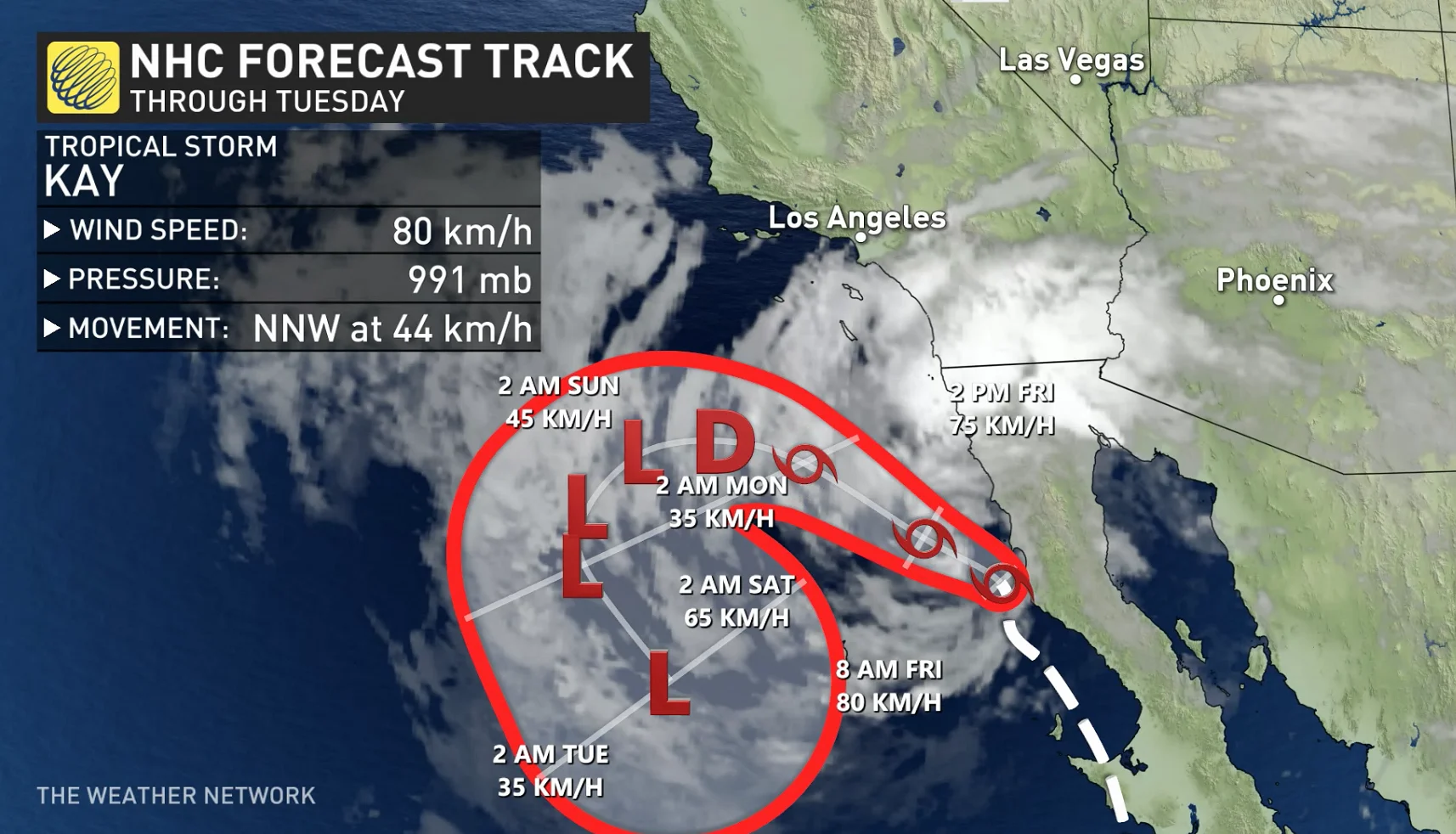
The storm weakened to a tropical storm by Thursday evening. Kay will continue moving north over the next couple of days as it weakens, coming close to far southern California as the storm gradually succumbs to the region’s cold waters.
While this storm won’t make landfall in California, nor will it reach California as a full-fledged tropical cyclone, forecasters expect Kay to have a significant impact on conditions across the southern third of the state.
California lurches from historic heat to flash flood threat
California is in the waning days of a historic heat wave that roasted vast swaths of the entire state with daytime high temperatures in the mid-40s. These searing afternoon temperatures were the hottest readings ever recorded in multiple cities, including Santa Rosa, Napa, and the state capital of Sacramento.
Kay’s arrival in the region will help break this pattern of unprecedented heat. The storm will weaken the ridge of high pressure that’s turned the western United States into an oven, allowing temperatures to fall back to tolerable levels.
However, the change isn’t all good news.
Gusty winds will pick up in southern California on Friday before the rains start falling. Gusts of 50 to 70 km/h at lower levels, with much stronger gusts at higher elevations, could worsen new and ongoing wildfires throughout the region before the rain begins later in the day on Friday. The winds could also lead to tree damage and power outages in some areas.
Drenching rains will reach southern California on Friday as the deep surge of tropical moisture flows northward.
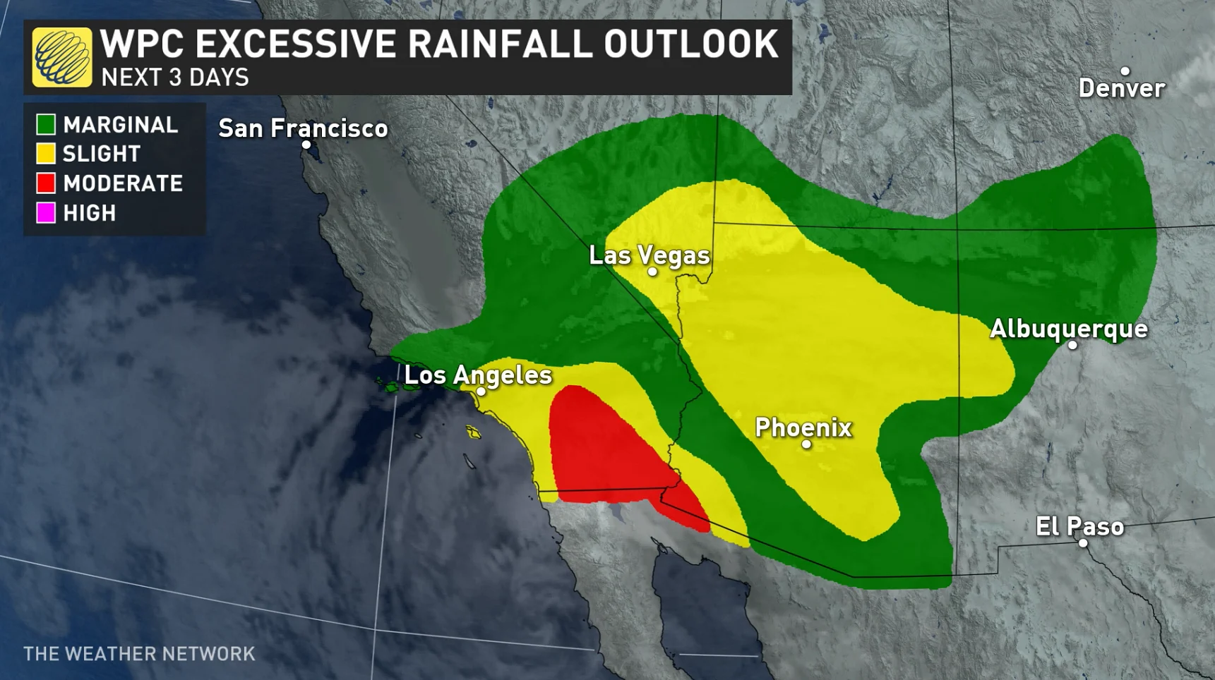
The U.S. Weather Prediction Center paints a widespread risk for flash flooding across most of southern California, including the Los Angeles and San Diego metro areas. The flood threat extends into Nevada and Arizona to include Las Vegas and Phoenix. The heaviest rains and greatest threat for flooding in the region will unfold on Friday.
WATCH: Searing heat wave shatters records from Saskatchewan to California
Tropical storms are extremely rare in California
Kay is among a rare handful of storms on record to come close to southern California. Sea surface temperatures off the California coast are far too cold for tropical cyclones to survive. These chilly waters force storms to rapidly weaken long before they reach the state.
Even the mere remnants of tropical storms have a tough time reaching California. The remnants of storms that track over the Baja Peninsula typically curve northeast toward Arizona and New Mexico.
MUST READ: Disastrous megaflood could cause historic damage in California, study warns
NOAA’s hurricane database shows that only five tropical storms have come within 250 km of San Diego since 1949. The most recent storm to reach California as an intact tropical storm was 1997’s Nora, which came inland from the Gulf of California and rolled across the Sonoran Desert near the Arizona border.
Only one tropical storm in the past century has made a direct landfall in California. An unnamed storm in 1939 brought gusty winds and heavy rain when it came ashore north of Los Angeles. A fast-moving hurricane grazed San Diego in 1858 and caused widespread damage as its high winds raked the area.
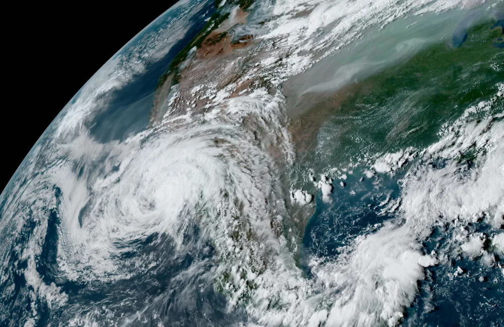
Thumbnail courtesy of NOAA.