Significant rains, warmth push into southern Ontario Sunday
Southern Ontario is in for a warm end to 2024 as an active storm track settles across the Great Lakes this weekend
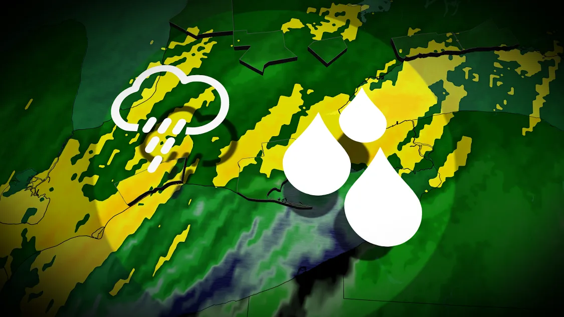
An unusually robust rainfall is in the forecast for southern Ontario as a new low-pressure system scoots into the Great Lakes region to end the final weekend of 2024.
Gulf moisture flowing north of the border will bring another wave of warmth and abundance of rainfall to southern parts of the province for our Sunday.
Given the heavy rainfall rates combined with snowmelt and still-frozen ground, stay alert for ponding and pooling of water in some areas.
SEE ALSO: Near-record rainfall streaming toward Ontario to end 2024
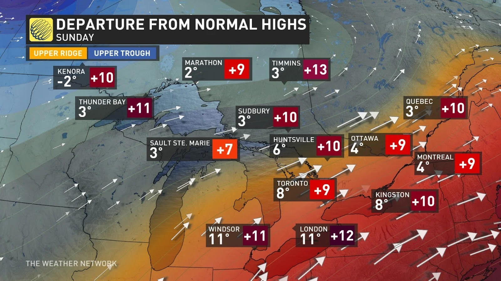
Saturday was an unusually warm one for much of Ontario, where temperatures came in 5 to as much as 20 degrees above seasonal to start the weekend. This warmth washed away the last traces of snow for much of the south.
Southern Ontario is no stranger to holiday melts. The week between Christmas and New Years has stayed below freezing only once in the past 20 years in Toronto. Seven of those 20 years have seen the temp surpass 10° C.
Warm weather melts Ontario's snow ahead of New Year's Day
Sunday: Round two and ample moisture
A new system moving into southern Ontario on Sunday will bring unusually high moisture and a greater temperature contrast into the region. Temperatures will return to below freezing in northwestern Ontario, while the Greater Toronto Area (GTA) and eastern Ontario could reach the double digits.
MUST SEE: Canada's impactful year of weather in 2024
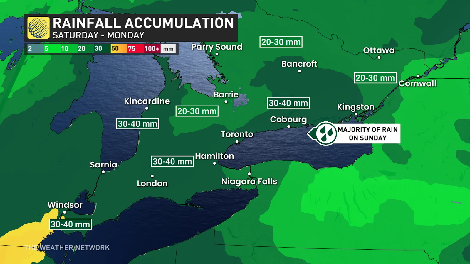
30-40 mm of rain will fall across southern Ontario and all the way toward Quebec City, starting in the afternoon.
The temperature will remain well above average across the province for several days, with temperatures 5-10 degrees higher in southern Ontario and Quebec and ranging between 10-20 degrees warmer for parts of northern Ontario and Quebec.
Stay tuned to The Weather Network for more forecast updates across Ontario.