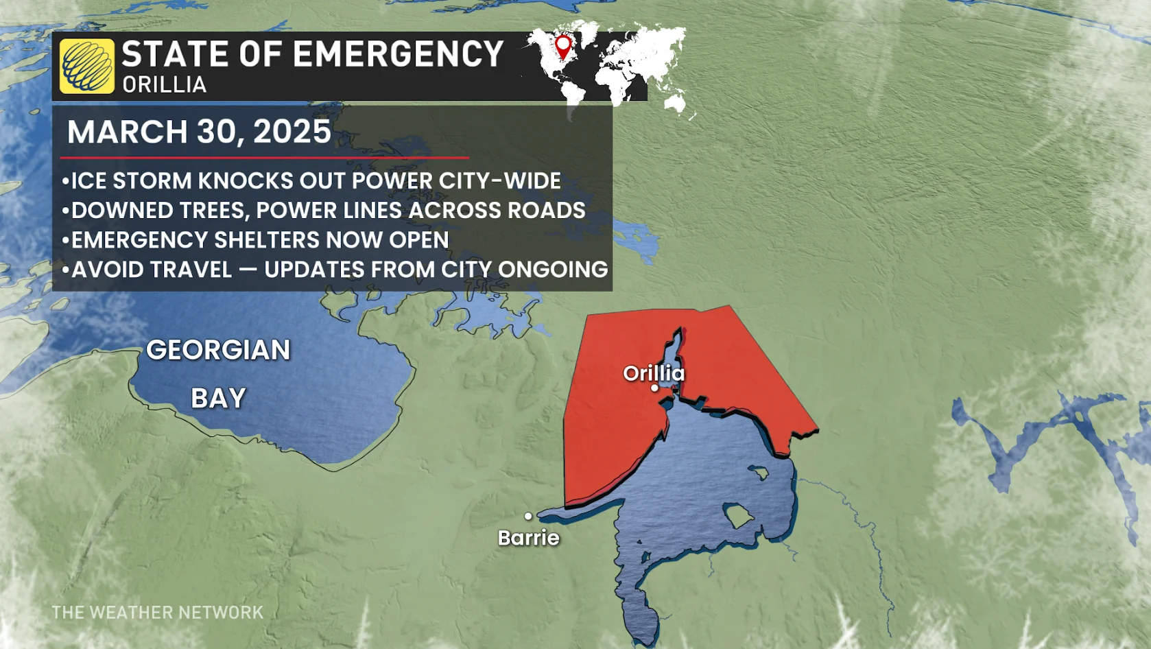
Ontario town in state of emergency as potent ice storm persists Sunday
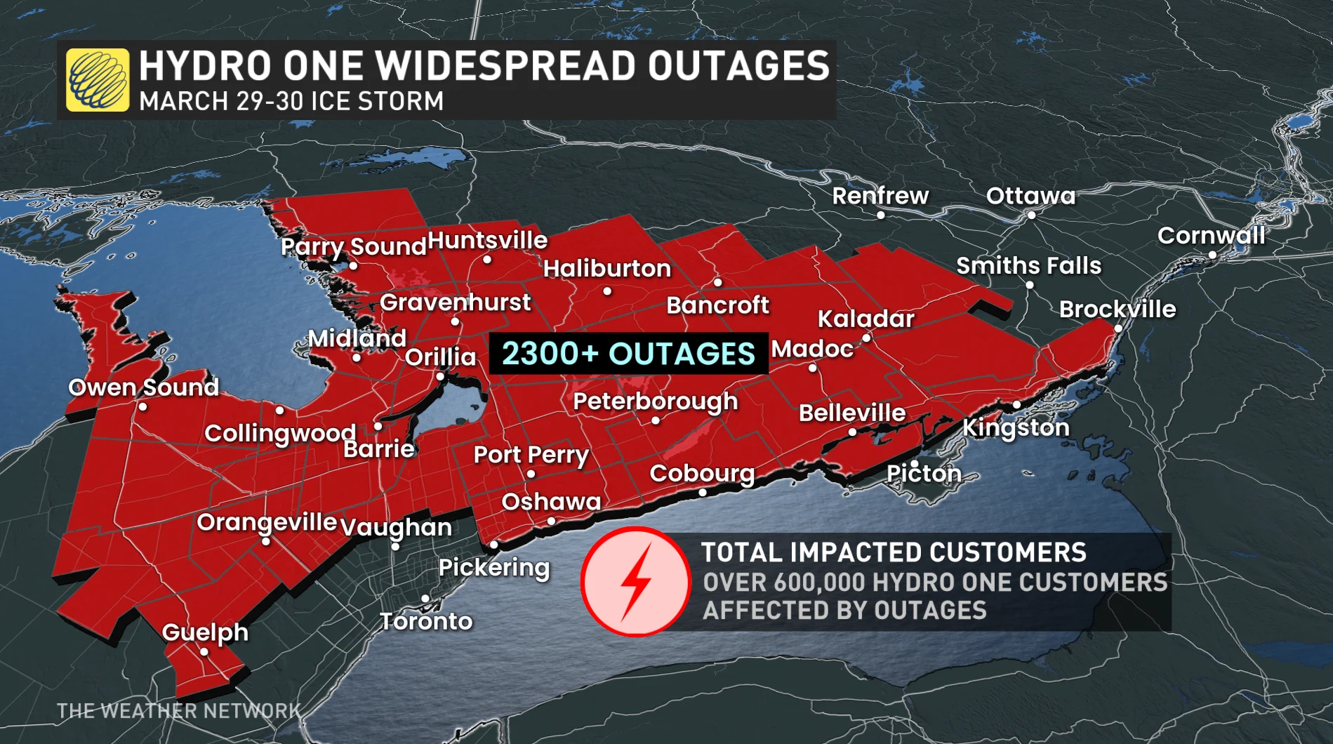
More than 370,000 homes and businesses lost power amid widespread, persistent freezing rain
A high-impact ice storm will continue into Sunday after hours of ice accretion knocked out power to more than 370,000 customers across Ontario as of early Sunday afternoon.
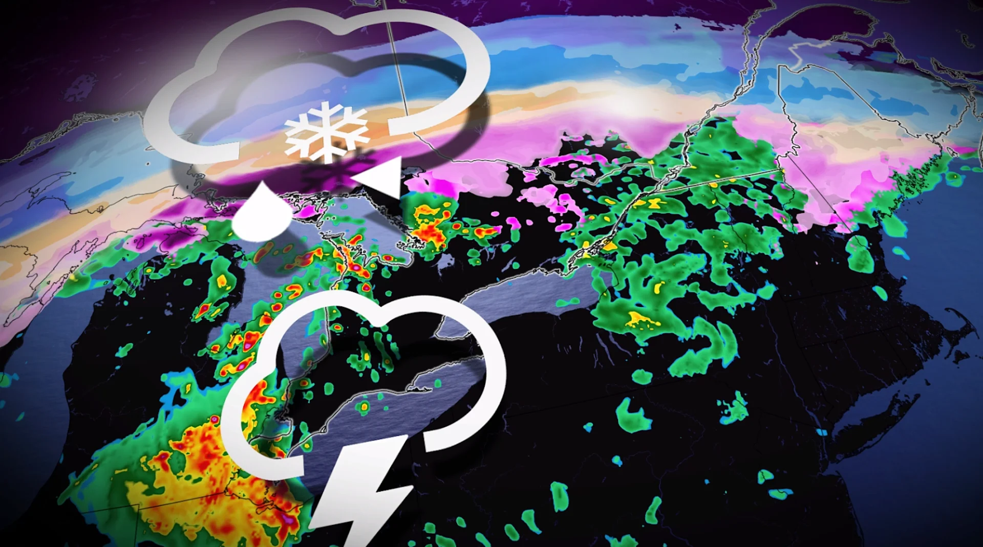
Expect widespread power outages to persist through the remainder of the weekend, along with treacherous driving conditions across communities experiencing freezing rain and heavy snowfall.
Stay home if possible during periods of freezing rain. Be sure to check highway conditions and local weather alerts before heading out if necessary.
PHOTOS: Damage, outages reported as ice storm hits Ontario
The cities of Orillia and Peterborough both declared a state of emergency on Sunday morning due to widespread power outages, downed trees, and dangerous road conditions across the city from the ice storm.
City officials are urging residents to stay in their homes and avoid travelling on the roads while crews work to restore power and clean up. They are also urging for minimal water use so as to not back up the sewer systems.
WATCH: Beware falling branches and power line hazards as ice lingers
Second round of ice continues into Sunday
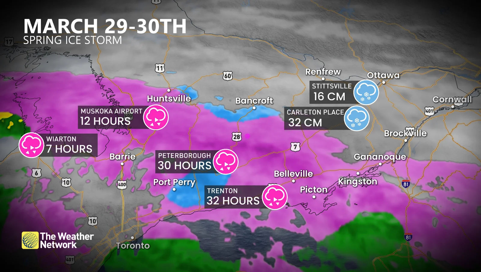
Widespread freezing rain fell across cottage country and eastern Ontario on Saturday, along with a hefty dose of snow throughout northeastern Ontario and the Ottawa Valley.
Precipitation picked back up Saturday night after a relative lull during the day, leading to additional ice accretion across many of the same areas already hit hard by ice buildup.
Forecasters expect a light glaze of ice to develop across portions of the Greater Toronto Area (GTA) as temperatures fall around the freezing mark into Sunday morning. The region could see 2-5 mm of ice accretion—not a high-impact event, but enough to make exposed surfaces slick.
Greater totals are expected immediately north of the GTA. Folks around Orangeville, Dundalk, Barrie, and Orillia could see an additional 15-20 mm of ice accretion Sunday. This is on top of what’s already fallen. Further power outages are likely.

DON'T MISS: Freezing rain and ice pellets are dangerous winter hazards
Widespread additional ice accretions of 10-15 mm are in the forecast throughout much of cottage country and eastern Ontario, with around 10 mm of ice expected on top of the snow that fell in and around Ottawa.
Temperatures across southern Ontario will gradually rise through the day Sunday, allowing precipitation to change over to plain rain and ice to begin melting off trees and power lines. This warmup will lead to a severe thunderstorm threat across southwestern Ontario by Sunday evening.
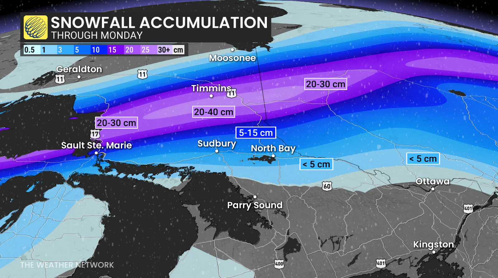
It’s not just southern Ontario bearing the brunt of this wintry storm. Communities north of Lake Huron are dealing with significant amounts of ice and snow as a Colorado low develops and moves across the region.
Sault Ste. Marie and Timmins are in line for 20-30 cm of snow through Monday, with some rural areas potentially seeing as much as 50 cm of accumulation. It’s likely that heavy snow will shut down Highways 11 and 17 near Lake Superior and Timmins on Sunday night into Monday.
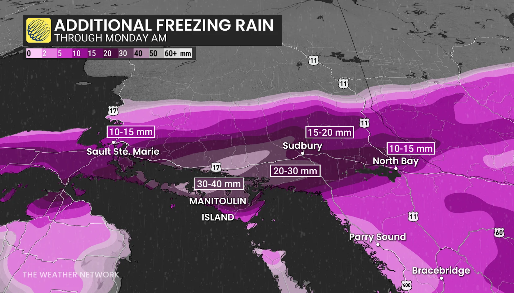
Immediately south of that swath of heavy snow, 30-40 mm of ice accretion from freezing rain could make for exceptionally tough travel along the Trans-Canada between Sault Ste. Marie and Sudbury.
Beyond, temperatures could briefly soar into the teens during Sunday night and early Monday ahead of a strong cold front, which will bring much colder weather back to the region to start April.
Stay with The Weather Network for all the latest on your forecast across Ontario.
Thumbnail image taken in Barrie, Ont., on March 30, 2025, by Mark Robinson/TWN.