Winds threaten ice storm cleanup in Ontario, still 350,000+ without power
A destructive and long-duration ice storm hit Ontario this weekend, leaving behind major tree and power line damage in its wake. Gusty winds on Monday could complicate cleanup efforts
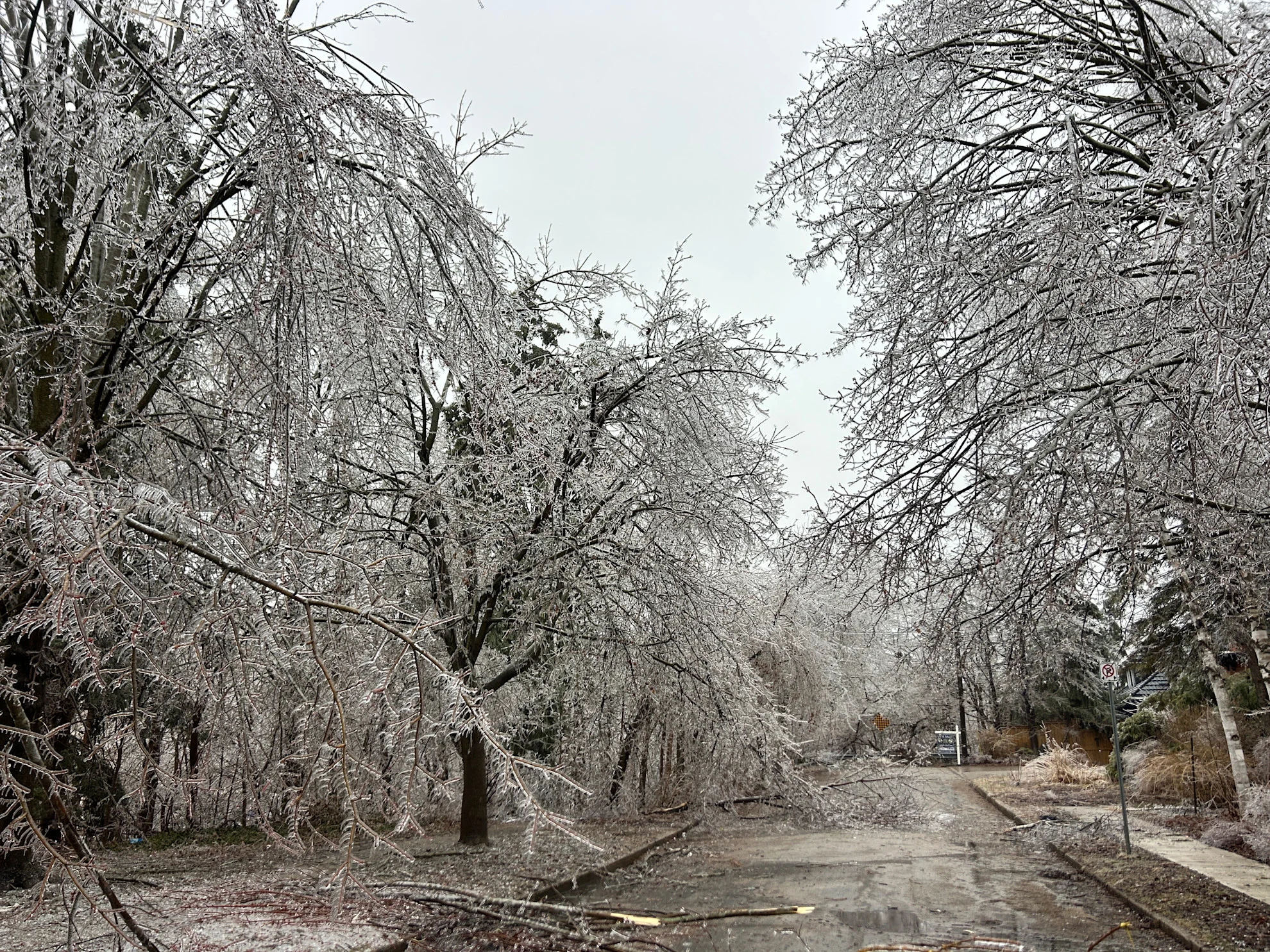
Hundreds of thousands of homes and businesses were still in the dark early Monday morning after a major weekend ice storm blasted a large swath of Ontario.
Multiple states of emergency have been declared due to the damage and power outages, including the cities of Orillia, Peterborough, the District of Muskoka and the Township of Oro-Medonte. Hydro One reported more than 375,000 power outages by Monday morning.
"It’s all hands on deck as crews continue to work alongside our contractors to restore power to customers," Hydro One stated on their website Monday morning. "We anticipate it will take several days to restore all customers."
Residents in affected areas are urged to stay clear of any fallen power lines, and to keep at least 10 metres back, even if it does not appear to be live, Hydro One officials warn.
PHOTOS: Ontario ice storm causes widespread damage, outages
City officials had also urged residents to stay in their homes and avoid travelling on the roads while crews work to restore power and clean up the storm impacts. Minimal water use is encouraged to avoid back up on the sewer systems.
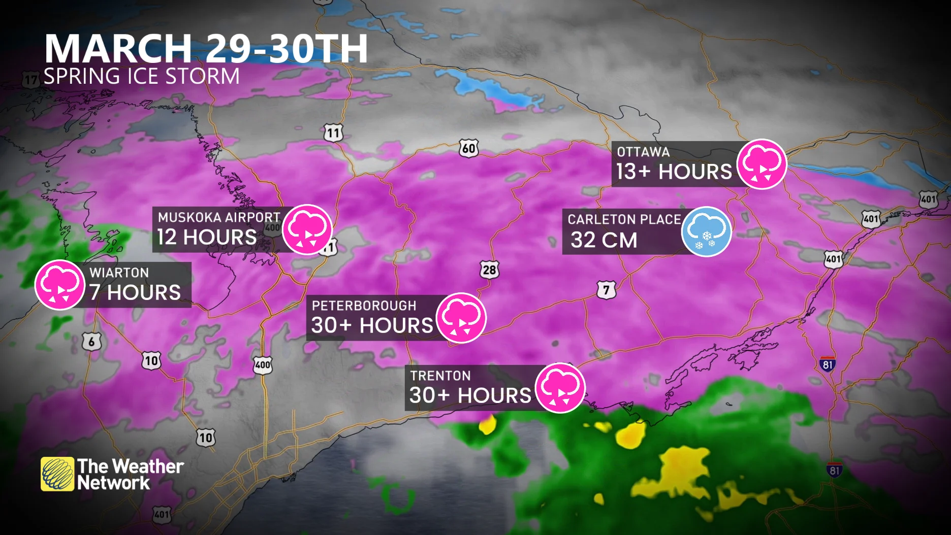
Peterborough and Trenton endured more than 30 hours of freezing rain between Friday night and Sunday. Folks around Ottawa saw more than 13 hours of freezing rain—and that arrived after a blanket of snow earlier in the storm.
Special weather statements issued for gusty winds Monday
While conditions will improve for southern Ontario as temperatures rise and the ice begins to melt, special weather statements have been issued for gusty winds and potential further impacts during the day Monday.

Northwest winds gusting near 50 km/h could result in additional damage to trees and powerlines that have already been impacted by a thick coating of ice.
Icy impacts continue across northeastern Ontario
Ongoing wintry impacts will continue across northeastern Ontario between Sault Ste. Marie and North Bay Monday, with extensive tree damage and widespread power outages throughout the region.
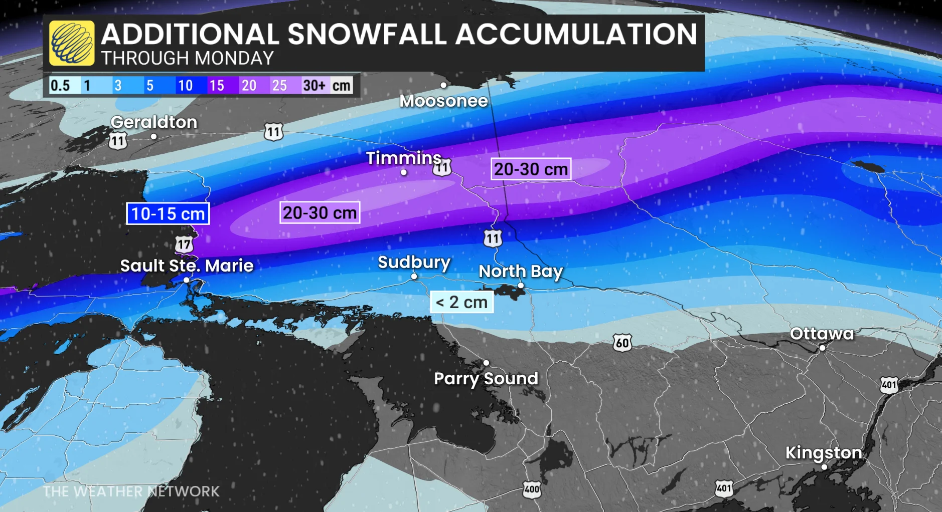
North of the ice, a formidable blanket of snow has accumulated between Highway 17 and Highway 11, including the Timmins area. Between 20-30 cm of snow was forecast to fall by Monday for these regions.
The wintry precipitation should ease later Monday as the system finally lifts out of the area.
WATCH: Surveying the damage in Barrie after ice-coated branches knocked down
Another strong low will track into the Great Lakes region for Wednesday. Primarily rain is expected, with a risk for thunderstorms, but a period of freezing rain is possible at the start of the system for northern parts of the region.
DON'T MISS: A typical April’s weather across Canada is one wild ride
An active pattern is expected through early April with changeable temperatures, which should tip to the cold side of seasonal. Most of April is expected to be changeable, with a lack of any consistent warm weather ahead.
Be sure to check back for the latest weather updates across Ontario.